|
|
Post by missouriboy on Jan 19, 2017 14:47:22 GMT
|
|
|
|
Post by nautonnier on Jan 19, 2017 15:02:02 GMT
Almost GrayWolf The DMI graph is the most disturbing one 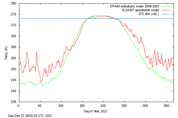 The Earth's atmosphere is a heat engine and the poles are the exit vents to space particularly during the winter months when they have close to zero insolation. The warm air that should have been further south keeping the Spanish courgettes (zucchini in US) growing has instead been blown to the pole where it is radiating through the open door at a significant rate (Stefan Boltzmann - increase by the fourth power for each degree K). This may be the reason there's been no step change up in atmospheric temperatures after the [use suitable hyperbole] 'El Nino' last year - all that heat that had been 'stored' in the ocean has vented to space already. So what will happen if the venting rate through the pole continues without a [use suitable hyperbole] 'El Nino' supplying it? As Harold Ambler would say - " don't sell your coat" |
|
|
|
Post by graywolf on Jan 19, 2017 15:18:33 GMT
It's this heat flow tearing gthrough the strat that has caught my attention. If low level clouds are not holding the warm ,moist air in the lower atmosphere ( where its energy is spent over the ice so limiting growth?) then there must have been an increase in the peturbations of the strat, over Barentsz/Kara in the autumn refreeze and then where ever the Jet Steers in the storms which ,sadly this and last year was into Barentsz/Kara.
I worry that the failure of the QBO to reverse last year was due to peturbations, from the Polar Strat , spilling into the Equatorial Strat ( messing with the gas mix over the UK leading to our Feb Ozone hole?) and so 'spinning up the QBO westerlies again?
Even if most of the energy does get 'spent' in the lower trop we must still be seeing extra energy in the strat over that spot?
It is not an either/or thing but surely it is a 'thing'
|
|
|
|
Post by missouriboy on Jan 19, 2017 15:22:38 GMT
So I tried past periods, I assume you saw that data is accessible back to 2014 but some missing days interferes with the loop  That low pressure is maybe doing what other potential cold outlooks have done this winter so far and been 'over modeled' if you like, at least for UK. ... So ... what do you think acid? Was this one over-modeled? Spain? UK? This west-to-east low pressure flow? How is this different than previous years? Is it just more cold air from the north? |
|
|
|
Post by nonentropic on Jan 19, 2017 17:29:41 GMT
|
|
|
|
Post by acidohm on Jan 19, 2017 18:08:16 GMT
So I tried past periods, I assume you saw that data is accessible back to 2014 but some missing days interferes with the loop That low pressure is maybe doing what other potential cold outlooks have done this winter so far and been 'over modeled' if you like, at least for UK. ... So ... what do you think acid? Was this one over-modeled? Spain? UK? This west-to-east low pressure flow? How is this different than previous years? Is it just more cold air from the north? Overmodelled in that initial model outputs suggested the high pressure ridge currently over UK and parts of Scandinavia would have moved west, allowing low pressure from north russia to sink down over Europe (which it has) and uk (which it hasn't, ridge holding it off) GFS has consistently shown a strong possibility of this happening, ie cold low moving from east to west, but in the end, at least for UK and often west Scandinavia....high pressure holds this back. Obviously those in southern and eastern Europe have really felt the effects of the polar air!! Apparently these conditions draw real parallels with those at a similar point in solar cycle 23, ie, N Europe near misses regarding cold. I'm not sure how different this is to previous years, I remember Very cold periods being compared to '63 for example. I have seen parts of the Thames frozen in the lee of the meanders in the past. (Marlow, it ain't London but still reasonable in width!) So the real key to a cold uk/Europe is either this cold low pressure 'retrogressing' east to west against the usual jet stream flow, or a blocking high circulating frigid air from siberia, however both outcomes are vigorously attacked by the westerly flow from the atlantic, I guess there's just so much more energy in it?? This year has been a bit in the middle so far, jetstream is very meridional as last year, we've been just outside the warm damp northbound flow mostly and had a bit of stagnant cold air when sheilded from this, had a taste of the southward bound air recently which gAve a bit of snow...but it's not really got in the groove for a real eastern sourced winter. Much of the rest of Europe has tho....but then that's similar to last year, just this year more so... Some reasonable strong indications of some stratospheric warming however....that could tip the balance....maybe... You guys in stateside haven't had it too warm tho have you?? There was a time when all things polar vortex were blamed on warm blobs and RRR....I guess icey conditions happen anyway!! |
|
|
|
Post by missouriboy on Jan 19, 2017 21:13:12 GMT
So ... what do you think acid? Was this one over-modeled? Spain? UK? This west-to-east low pressure flow? How is this different than previous years? Is it just more cold air from the north? Overmodelled in that initial model outputs suggested the high pressure ridge currently over UK and parts of Scandinavia would have moved west, allowing low pressure from north russia to sink down over Europe (which it has) and uk (which it hasn't, ridge holding it off) GFS has consistently shown a strong possibility of this happening, ie cold low moving from east to west, but in the end, at least for UK and often west Scandinavia....high pressure holds this back. Obviously those in southern and eastern Europe have really felt the effects of the polar air!! Apparently these conditions draw real parallels with those at a similar point in solar cycle 23, ie, N Europe near misses regarding cold. I'm not sure how different this is to previous years, I remember Very cold periods being compared to '63 for example. I have seen parts of the Thames frozen in the lee of the meanders in the past. (Marlow, it ain't London but still reasonable in width!) So the real key to a cold uk/Europe is either this cold low pressure 'retrogressing' east to west against the usual jet stream flow, or a blocking high circulating frigid air from siberia, however both outcomes are vigorously attacked by the westerly flow from the atlantic, I guess there's just so much more energy in it?? This year has been a bit in the middle so far, jetstream is very meridional as last year, we've been just outside the warm damp northbound flow mostly and had a bit of stagnant cold air when sheilded from this, had a taste of the southward bound air recently which gAve a bit of snow...but it's not really got in the groove for a real eastern sourced winter. Much of the rest of Europe has tho....but then that's similar to last year, just this year more so... Some reasonable strong indications of some stratospheric warming however....that could tip the balance....maybe... You guys in stateside haven't had it too warm tho have you?? There was a time when all things polar vortex were blamed on warm blobs and RRR....I guess icey conditions happen anyway!! We can't complain here in Columbia. The ice storm spared us, We had 1 night mid Dec. that dropped to -2F (-18C). London Dec. temp is shaping up to be the coldest since 2010, if the first 19 days are any indication (according to Weather Underground) ... averaged 4C versus 2010 whole month of 3.3C. The CET showed -0.7C??? Hope you continue to avoid the beast. I assume that Spanish snow resulted partially from that west-to-east low that hit the coast on the 19th. It's forecast to be over London by the 24th? www.weatheronline.co.uk/cgi-bin/expertcharts?LANG=en&MENU=0000000000&CONT=euro&MODELL=gfs&MODELLTYP=1&BASE=201701100600&VAR=pslv&HH=114&ZOOM=0&WMO=&ARCHIV=0&LOOP=1&RES=0 |
|
|
|
Post by Ratty on Jan 19, 2017 23:12:05 GMT
Fake news needs fake pictures.  |
|
|
|
Post by missouriboy on Jan 19, 2017 23:21:05 GMT
Fake news needs fake pictures. That's f Lake news Ratty. |
|
|
|
Post by Ratty on Jan 20, 2017 0:12:33 GMT
[ Snip ]That's f Lake news Ratty. TV! Now! |
|
|
|
Post by missouriboy on Jan 20, 2017 0:38:03 GMT
|
|
|
|
Post by graywolf on Jan 20, 2017 11:38:36 GMT
So ... what do you think acid? Was this one over-modeled? Spain? UK? This west-to-east low pressure flow? How is this different than previous years? Is it just more cold air from the north? Overmodelled in that initial model outputs suggested the high pressure ridge currently over UK and parts of Scandinavia would have moved west, allowing low pressure from north russia to sink down over Europe (which it has) and uk (which it hasn't, ridge holding it off) GFS has consistently shown a strong possibility of this happening, ie cold low moving from east to west, but in the end, at least for UK and often west Scandinavia....high pressure holds this back. Obviously those in southern and eastern Europe have really felt the effects of the polar air!! Apparently these conditions draw real parallels with those at a similar point in solar cycle 23, ie, N Europe near misses regarding cold. I'm not sure how different this is to previous years, I remember Very cold periods being compared to '63 for example. I have seen parts of the Thames frozen in the lee of the meanders in the past. (Marlow, it ain't London but still reasonable in width!) So the real key to a cold uk/Europe is either this cold low pressure 'retrogressing' east to west against the usual jet stream flow, or a blocking high circulating frigid air from siberia, however both outcomes are vigorously attacked by the westerly flow from the atlantic, I guess there's just so much more energy in it?? This year has been a bit in the middle so far, jetstream is very meridional as last year, we've been just outside the warm damp northbound flow mostly and had a bit of stagnant cold air when sheilded from this, had a taste of the southward bound air recently which gAve a bit of snow...but it's not really got in the groove for a real eastern sourced winter. Much of the rest of Europe has tho....but then that's similar to last year, just this year more so... Some reasonable strong indications of some stratospheric warming however....that could tip the balance....maybe... You guys in stateside haven't had it too warm tho have you?? There was a time when all things polar vortex were blamed on warm blobs and RRR....I guess icey conditions happen anyway!! I'm sure i posted enough times my 'hopecast' back in Sept where I cited WACCy weather and Low Solar as the major forcings for the Weather around the N.Hemisphere for the winter 2016/17. I'm not saying we're done with winter here in the UK, that west Siberian Snow scattergun still has a couple of months in it to go so the upcoming polar Strat disruption could just lead to the positioning of the H.P. we need to draw in that cold? Any Atlantic moisture then trailing over us would bring heavy snow? And guess what? I'd say next winter will seem an even more extreme WACCy winter with Low Solar further in control over the N.Atlantic with the UK again shielded from flooding but not from extended cold outbreaks and snowy interludes. The upcoming Strat peturbations might leave a split vortex that would then struggle to re-form into a strong PV before the Final Warming in late Feb/early March. If I'm right that leaves the Arctic front door wide open for the last bit of winter and more cold plunges/WAA. Not good for melt season as we have seen no deep cold entrench over the basin with DMI 80N still running hot and not yet touched 'average' since early Sept. It is not about the final numbers any more but the amount of Arctic Basin open water across the season and the energy absorbed. With a worse winter than last year , and that winter was so bad that a cloudy cool June/July/Aug still left us joint second lowest?, what should we expect with regard to energy absorbed by the basin over this coming melt season? Should we see warm Neutral ENSO all summer then the rest of the Hemisphere could be in for a hot year? |
|
|
|
Post by Ratty on Jan 20, 2017 12:16:34 GMT
You could be right GreyWolf. It's certainly continuing hot and above average in my part of the world.
|
|
|
|
Post by glennkoks on Jan 20, 2017 13:07:25 GMT
Above average in my part of the world. Well above normal. We had a polar outbreak in early January that lasted two days. Just long enough and cold enough to kill my garden then right back to record warmth.
|
|
|
|
Post by missouriboy on Jan 20, 2017 14:09:20 GMT
You could be right GreyWolf. It's certainly continuing hot and above average in my part of the world. However, I do remember Astro forecasting that summer 2017 would be a last scorcher before the descent. |
|


